Add beautiful,
it's in our nature
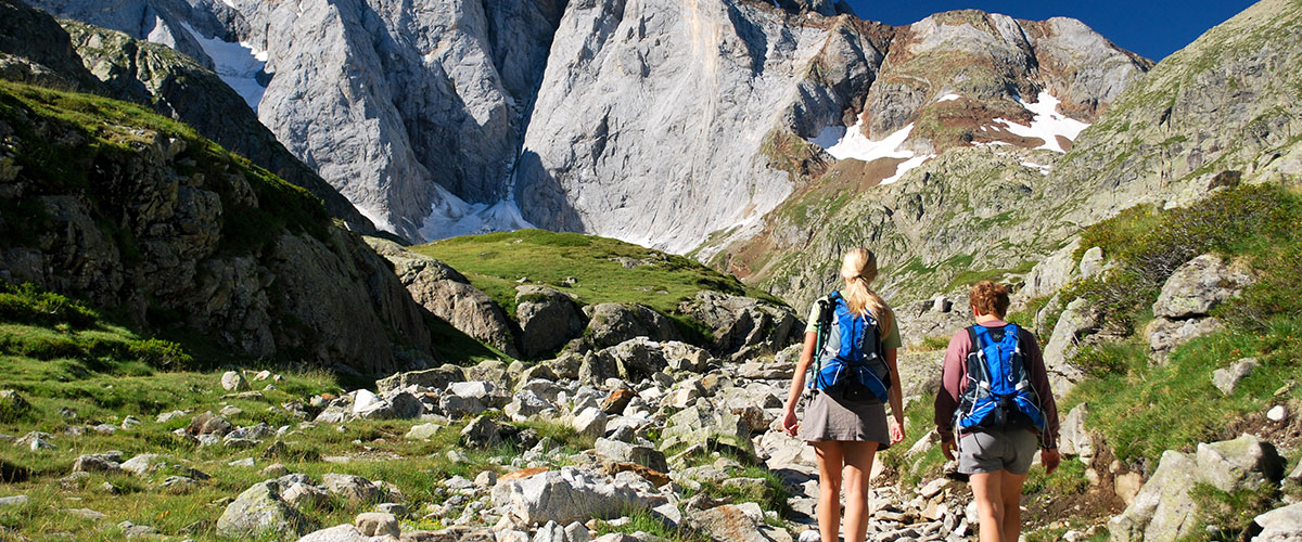
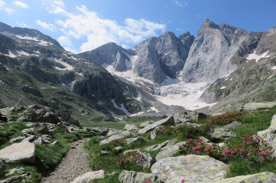
Hikes on peaks up to 2000+
Here are ten of the most beautiful and longest hikes from Cauterets, totaling 14,000 meters of elevation gain... a paradise for mountain lovers! Magnificent routes that will offer you incomparable views of the massifs and valleys of the High Pyrenees.
Mountain experience, and even climbing experience for the final ascent, will be necessary. The accompaniment of a guide is recommended to ensure safe and correct routes.
Pic du Cabalir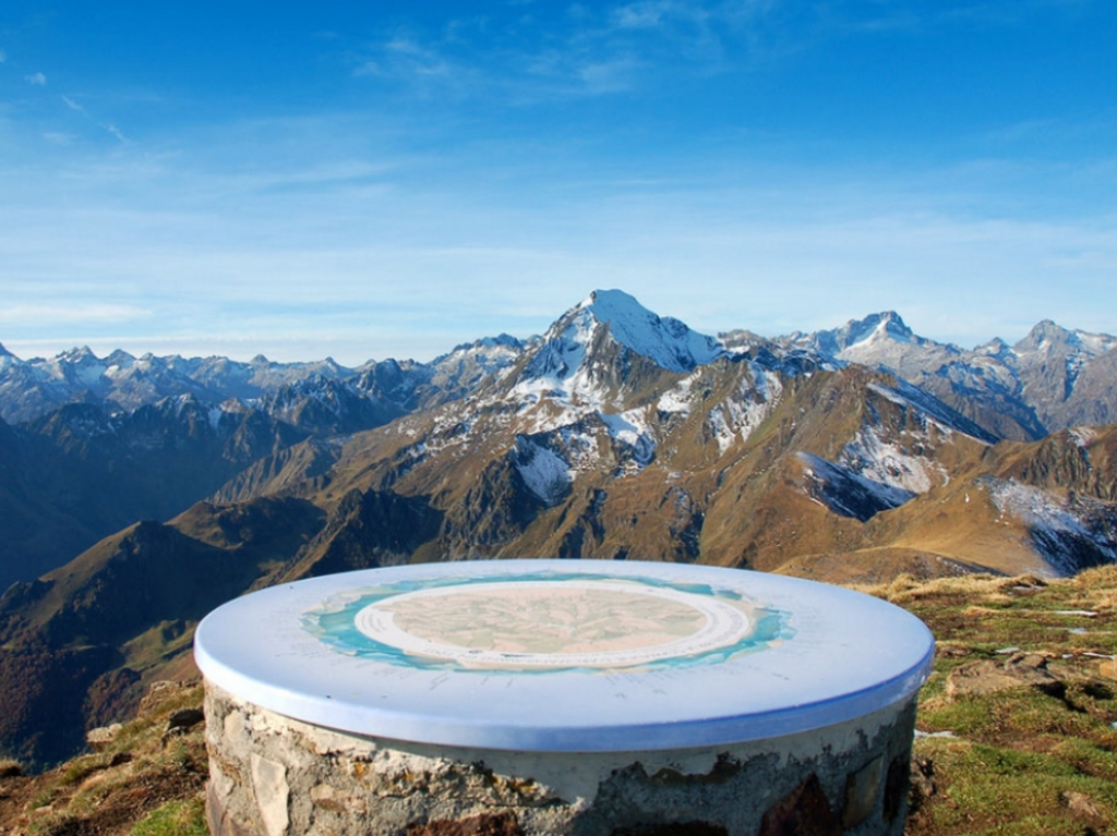 (2332 m)
Distance 9.5 km - Elevation gain 700 m -
Approximate duration 4h30.
One of the highest viewpoints in the Hautes-Pyrénées, in the Saint-Savin region, which hosts a magnificent trail race every year.
At the summit, a viewpoint indicator helps identify all the peaks in sight: Vignemale, Balaïtous, Pic du Midi de Bigorre, Néouvielle, etc.
The starting point is at the end of the Sireix forest road. It is also possible to start from Cauterets; the trail is well-marked but obviously much longer (17 km) with a significant elevation gain (1300 m); allow approximately 7 hours excluding breaks.

Pic de Viscos (2141 m)
Distance 10 km – Elevation gain 600 m -
Approximate duration 5 hours.
An iconic peak, easily recognizable by its pyramidal shape. The 360° view over the Luz and Cauterets valleys is fabulous. From Chalet La Source, the cross at its summit is clearly visible with binoculars.
This hike requires good physical condition, good weather, and sure footing.
The starting point is the Béderet parking lot (1670 m), via the track that passes in front of the chairlift departure point. The trail ascends to the Col de Riou (1949 m), then follows the ridge to a small pass at the foot of Pic de Viscos: the path then climbs steeply towards the summit. This steep and slippery section requires great caution.
Pic de Viscos overlooks Pic de Soulom (1763 m) and Pic des Piquets, located slightly lower down. The Soulom-Viscos crossing is also a beautiful classic.
 The ridges of the Ardiden Massif (2058 to 2577 m)
Distance 6 to 10 km – D+ 500 to 850 m -
Duration 3 to 5h
This massif offers many hiking destinations, starting either from Cauterets for the West side (via Cancéru), or from Luz-Ardiden for the East side (from the Aulian or Béderet parking lot): Pène Nère (2058 m), Tuc des Arribans (2088 m), Soum des Aulhères (2168m), Soum de Peyre Haute (2336 m), la Caperette (2395 m), Pic d'Aulian (2481 m), and the highest point, the Soum d'Arriou-Né (2577 m).
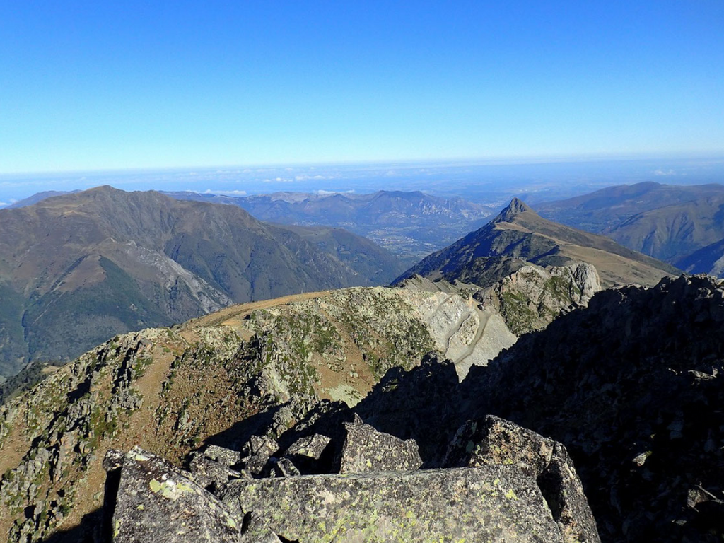
From the ridges, the panorama is magnificent, towards the Viscos to the North, the Vignemale and the Pic du Midi de Bigorre to the South, the Azun valley, the Lutour valley...

Riou Pass (1949 m), Lisey Pass (2086 m) and loop around the Lisey Plateau.
Distance 12 km – Elevation gain 1140 m – Approximate duration 6 hours
A magnificent hike, long but without any major difficulties. The starting point is behind the Caesar's Baths in Cauterets, via the GR trail that climbs to the old Pause baths, or more quickly from the village of Cancéru. You'll reach the Chalet de la Reine Hortense, the first viewpoint overlooking Cauterets with a beautiful view of the Cambasque valley.
Continuing uphill, take the path on the left that leads into the undergrowth towards the Col de Riou. Then head south (to the right) to reach the Col du Lisey, climbing towards the ridge of the Pène Blanque du Lisey. Finally, descend south to reach the Lisey plateau.
The walk around the plateau is splendid, wooded with beech, silver fir, Scots pine, and larch. Pure bliss!
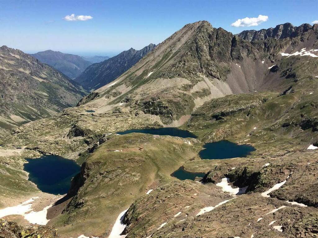
 Soum des Agudes (2732m), Soum de Bat Houradade (2722m)
Distance 13 km – D+ 1150m – Indicative duration 6h
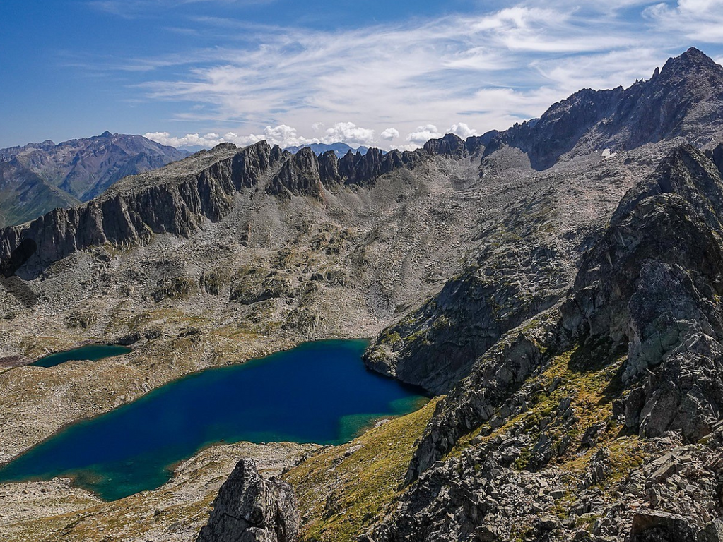
A mountain hike starting from the Aynis barns (1410m) above the village of Grust. Following the Ardiden lakes route, you first pass Lake Lagues, then Lake Cantet, and finally Lake Grand (2437m). You skirt the latter to the north to ascend the grassy slope leading to the ridge, just south of Pointe des Agudes. You then reach Soum des Agudes via the ridge. Next, descend towards the Lamous pass (2628m) to reach the foot of Soum de Bat Houradade.
The descent is made via the same route, or by passing at the foot of Aiguille de Lahazère, traversing above Lake Lahazère.
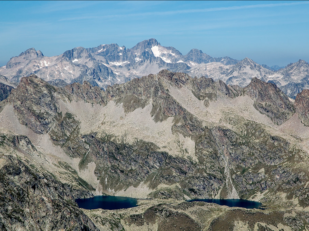 Culaus Peak (2806 m), Cestrède Peak (2947 m)
Distance 20 km – Elevation gain 1900 m – Approximate duration 7 hours
This is a long hike into the rocky landscape of the Culaus (2660 m and 2806 m) and Cestrède (2918 m and 2947 m) peaks, along a ridge stretching for over two kilometers, from the Soum det Guingays (2451 m) in the west to the Pointe de Cestrède. Experienced climbers are required to complete the ascent to the peaks.
The starting point is La Fruitière (1371 m), from which the summits are already clearly visible. After passing the Russel refuge, the trail leaves the path and enters the valley dominated by the lower Culaus peak, where patches of grass still remain. The climb to the peak then continues amidst the boulders. From the summit, there is a magnificent view of the Lutour valley, the Estibe Aute lakes, and the Balaïtous mountain.
We reach the junction with the Pic de Cestrède by descending towards the Kent pass.
The descent is long, first through scree via the Culaus pass (2565 m) then the Culaus valley where we find grassy areas again.
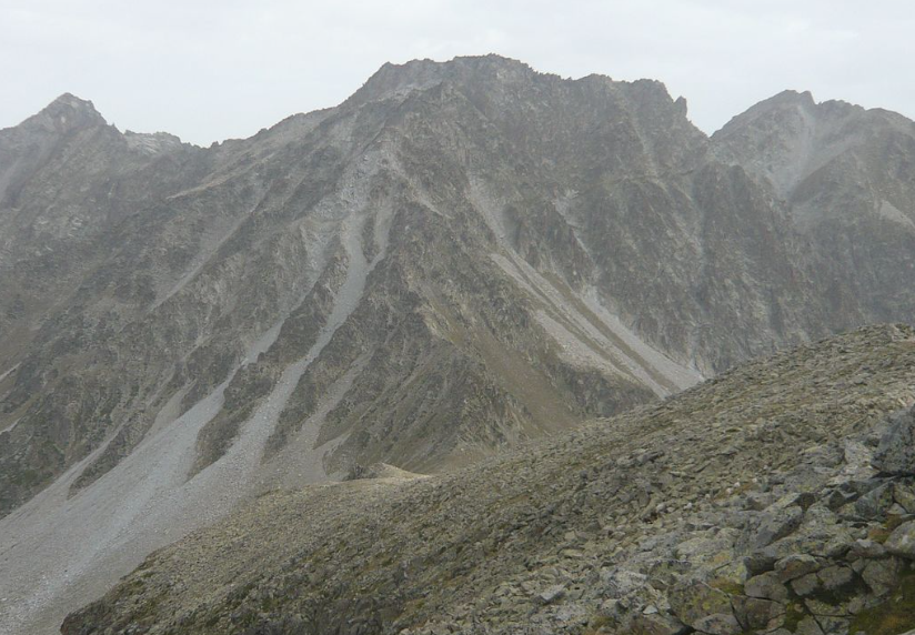
 Pic de Pébignau (2895 m)
Distance 14 km – D+ 1600 m – Indicative duration 5 hours
This peak is not visible from Chalet La Source, as it is hidden by the Culaus in the foreground.
From La Fruitière (1371m), head towards the lake and hotel of Estom (1804m). Continuing uphill, leave the path to the Col d'Arraillé on your right to reach Lac de Labas (2298m) and then the small lakes of Estibet (2360m), at the foot of Pic de Pebignau.
The climb to the summit is initially grassy, then becomes rocky. At the summit (2895m), there are views of the peaks of Ardiden, Cestrède, Male Rouge, Soum d'Aspé, Pic de Labas, Pic de la Sède, Col and Pic d'Arraillé, Estibe Aute, the Estibe Aute lakes, and the Estom lakes.
Pic Mayouret (2688 m)
Distance 11 km - Elevation gain 1300 m -
Approximate duration 8 hours.
This is the peak visible from Chalet La Source on the right, just behind Mont Péguère.
Starting from the Pont d'Espagne parking area, this is a long hike for experienced hikers. It's well worth the effort, as Pic Mayouret, rarely visited and wild, offers a magnificent viewpoint.
Upon reaching the Gaube hotel, head due east to spot a cairn and take a very steep path that climbs into the woods. Emerging from the woods, pass at the foot of Pic Meya and continue east towards a scree slope that ascends to the ridge line and leads to the summit.
For the return loop, follow the Clot de La Badète, skirting Pic de Labasse on the left and Soum de Peyre Lance on the right.
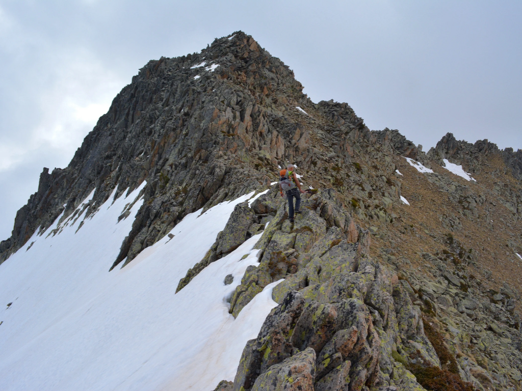
 Chanchou Peak (2949 m)
Distance 18 km – Elevation gain 1600 m – Approximate duration 6 hours
With Chanchou, we're getting close to 3000 meters!
The normal route starts from La Fruitière (1374 m), via the Col de Culaus (2565 m). From there, you ascend towards the summit of Chanchou along the south ridge. The final climb requires some climbing experience.
It's also possible to go via the Badet d'Aubiste valley and Lake Badet (1800 m elevation gain).

Ardiden Peak (2988 m)
Distance 15 km – Elevation gain 1600 m - Approximate duration 8h30
A relatively uncrowded hike, whose summit offers a breathtaking panorama. Ardiden is just 12 meters shy of joining the exclusive club of Pyrenean 3000-meter peaks.
From La Fruitière, the route first leads to the Russell refuge (1980m) after a 2-hour hike. Continue southeast towards the Culaus pass. Following the cairns on the left, the trail branches off towards the Pourtau des Agudes gap, about an hour away. The path then becomes indistinct among the boulders, but the cairns remain clearly visible. From the gap, it takes another 1 to 1.5 hours to reach the summit.
 Pic du Petit Vignemale (3032 m) and Pique Longue (3298 m)
Petit Vignemale: Distance 26 km – D+ 1600m – Indicative duration 12 hours
The Vignemale massif, the highest point in the French Pyrenees, at the end of the Gaube valley, is not visible from the Chalet, hidden behind Mont Péguère.
The hike begins at Pont d'Espagne (1473 m), following the GR10 which passes by the Oulettes de Gaube refuge (2151 m), reached after a 2 hour 45 minute walk, and then 2 hours later by the Hourquette d'Ossoue pass (2734 m). The path climbs along the ridge of Petit Vignemale, reaching its summit in 1 hour from the Hourquette.
The return is via the same route.
Most of these peaks are visible from Chalet La Source ... a panorama that is a true invitation to discovery! For these mountain hikes, don't hesitate to use a guide from among the chalet's partners, Caminando or Acumpanyat .
A big thank you for their magnificent photos, to Mariano (TopoPyrénées) and Julien Liron (Rando Vallées de Gavarnie) .
![]()
