Chalet La Source: Breathtaking view of the peaks!
 The panorama from Chalet La Source is a true invitation to discovery.
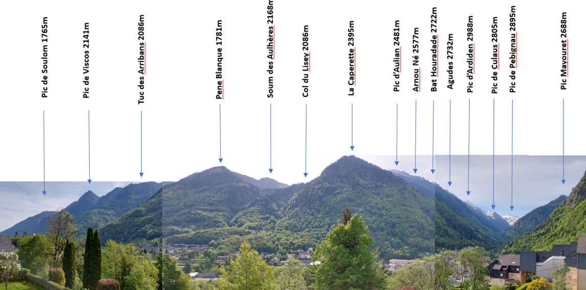
All along the horizon, around twenty peaks follow one another, culminating at 2000m on the north side of the valley - Soulom, Viscos - and nearly 3000m towards the border range to the south.
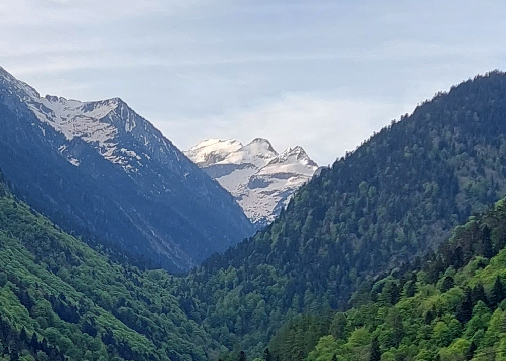
The view you'll love from the Chalet: the snow-capped peaks of
Culaus and Pebignau, set against the green backdrop of the wooded slopes... whatever the season, you'll never get tired of it!
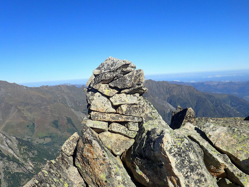
Cabaliros Peak (2332 m)
Duration 4h30 - Distance 9.5 km - D+ 700 m
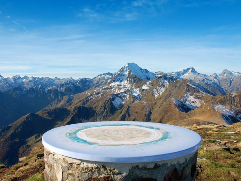 Located to the far left of the chalet (west slope, north side), it is one of the highest viewpoints in the Hautes Pyrénées, in the Saint Savin region.
The start of the hike is at the end of the Sireix forest road. At the summit, an orientation table will help you recognize all the peaks in sight: Vignemale, Balaïtous, Pic du Midi de Bigorre, Néouvielle.
It is also possible to leave from Cauterets, the trail is well marked and without difficulty but obviously much longer (17 km) with a steep gradient (D+1300m); it should then take about 7 hours excluding breaks.
Note: this is also the site, every year, of a magnificent trail of the same name.
Viscos Peak (2141 m)
Duration 5 hours – Distance 10 km – D+ 600 m
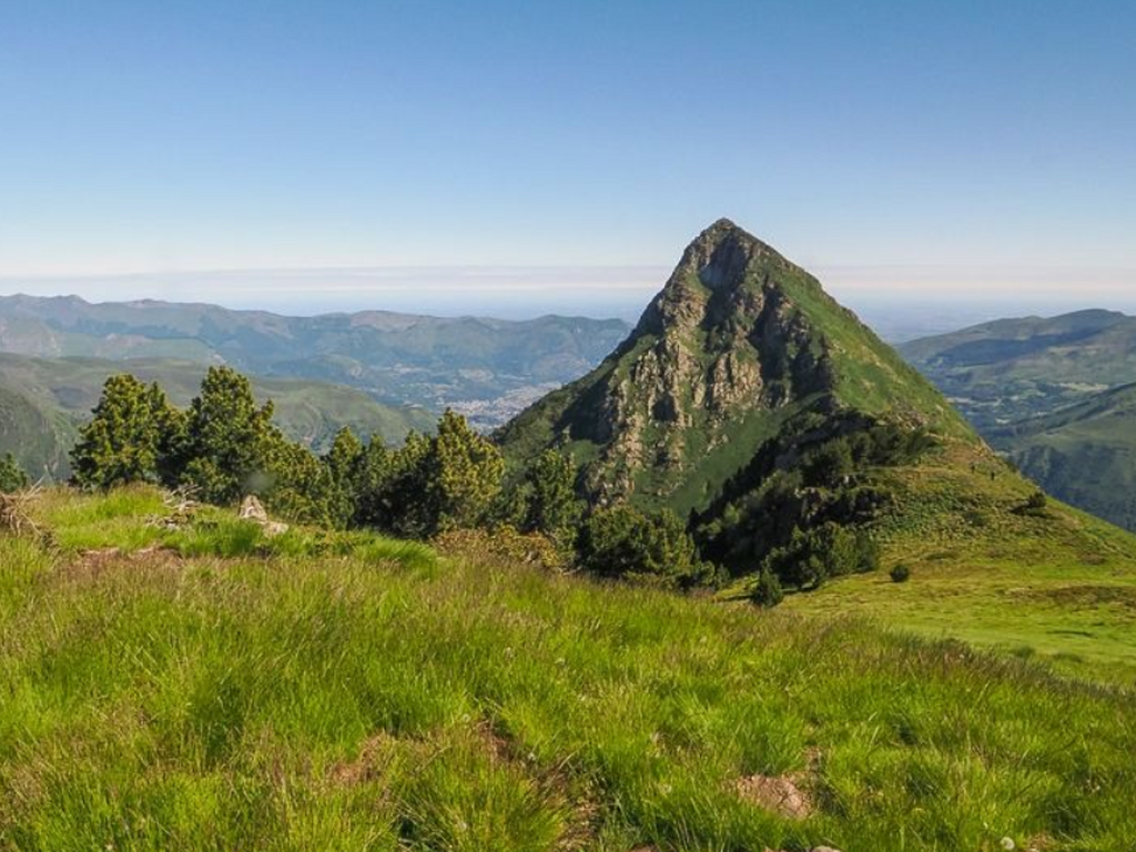 We change slopes to look opposite the Chalet, towards the left (north side). We can see a pyramid-shaped peak, as if carved with a knife. With binoculars, a wrought iron cross stands out clearly at its summit: it is the Pic de Viscos. From its summit, it offers a fabulous 360° view of the Luz and Cauterets valleys.
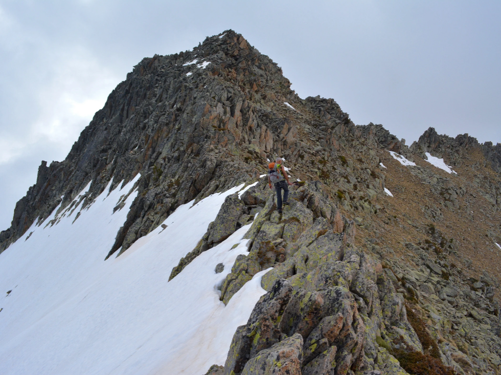
This hike requires good physical condition, good weather, and surefootedness for the final section.
The start is at the Béderet car park (1670 m), via the track that passes in front of the chairlift departure point. We climb to the Col de Riou (1949 m), then to the ridge. At the end of this, the path reaches a small pass at the foot of the Pic de Viscos: the path then rises sharply towards the summit. This steep and slippery section requires great caution.
From Viscos, you can overlook the Soulom peak (1763 m) and the Piquets peak a little lower, right next to it. The Soulom Viscos hike is a beautiful classic.
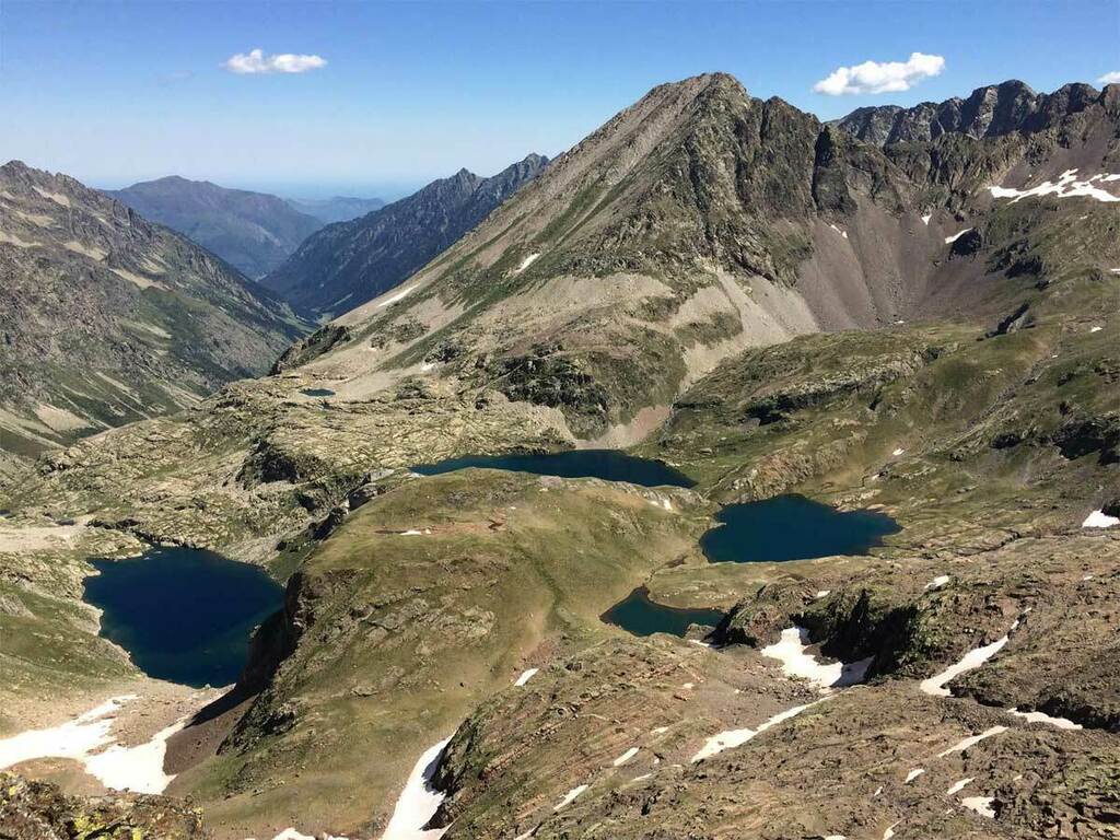
The ridges of the Ardiden Massif (2058 to 2577 m)
Duration 3 to 5 hours – Distance 6 to 10 km – D+ 500 to 850 m
 Following the ridge opposite the chalet, several peaks are scattered, more or less connected to each other, forming a massif which offers numerous hiking trails.
The departure will be either from Cauterets for the western slope (via Cancéru), or from Luz-Ardiden for the eastern slope, on the other side of the valley (from the Aulian or Béderet car park).
The different peaks will be: Pène Nère (2058 m), Tuc des Arribans (2088 m), Soum des Aulhères (2168 m), Soum de Peyre Haute (2336 m), la Caperette (2395 m), Pic d'Aulian (2481 m), and the highest point, the Soum d'Arriou-Né (2577 m, photo opposite).
From the ridges, the panorama is magnificent, towards the Viscos to the North, the Vignemale and the Pic du Midi de Bigorre to the South, the Val d'Azun, the Lutour Valley...
Col de Riou (1949 m), Col du Lisey (2086 m) and tour of the Plateau de Lisey
Duration 6 hours – Distance 12 km – D+ 1140 m
 Directly opposite Chalet La Source, on the other side of the Col de Lisey, lies the magnificent plateau of the same name. It is the site of a magnificent mid-mountain hike, quite long but without major difficulty.
The start is behind the Thermes de César, via the GR which climbs to the old thermal baths of Pause, or more directly from the village of Cancéru. We reach the chalet of Queen Hortense, 1st balcony of Cauterets with a beautiful view of the Cambasque valley.
Continuing the climb, the path on the left goes into the undergrowth towards the Col de Riou. We then turn south (right) to reach the Col du Lisey, going up towards the ridge of the Pène blanque du Lisey. We finally descend to the south to reach the Plateau du Lisey.
The tour of the plateau is splendid, wooded with beeches, silver firs, Scots pines and other larches. Pure bliss!
Soum des Agudes (2732m), Soum de Bat Houradade (2722m)
Duration 6h – Distance 13 km – D+ 1150m
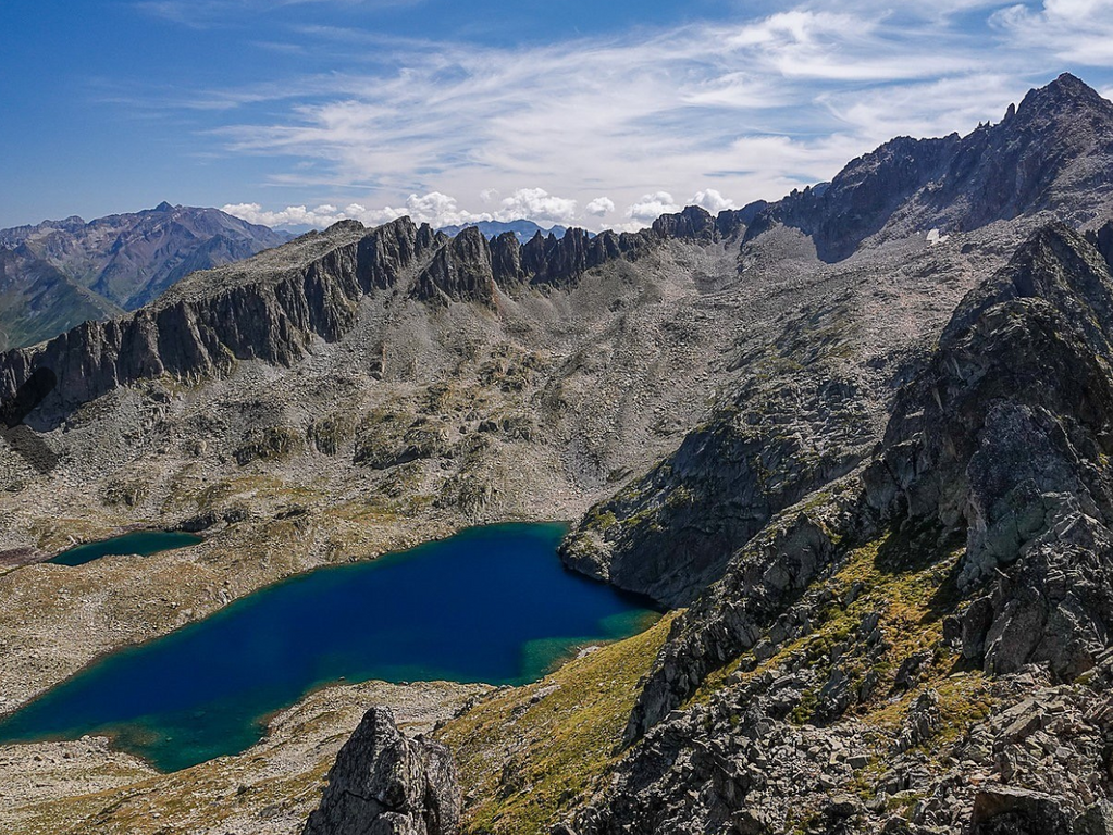 With these two peaks, we gain a notch in altitude, the vegetation becomes scarcer and gives way to rocks. It is a very mountainous hike, from the barns of Aynis above the village of Grust (1410m).
Following the Ardiden lakes route, we first pass the small lake of Lagues, then the small lake (Cantet lake, 2382m) and finally the Grand Lake (2437m). We go around it to the north to climb the grassy slope which leads to the ridge, just south of the Pointe des Agudes. We then reach the Soum des Agudes via the ridge. Then it is a descent towards the pourtère de Lamous (2628m) to reach the foot of the soum of Bat Houradade.
The crossing to the Soum of Bat Houradade is made along the ridge, to descend to the foot of the Soum of Bat Houradade, before the last climb by the ridge line.
The descent is made by the same route, or by passing at the foot of the Aiguille de Lahazère by crossing above the lake of Lahazère.
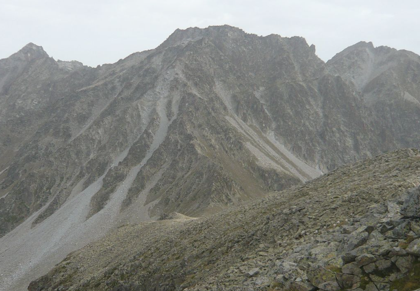
Pic de Culaus (2806 m), Pic de Cestrède (2947 m)
Duration 7h - Distance 20 km – D+ 1900 m
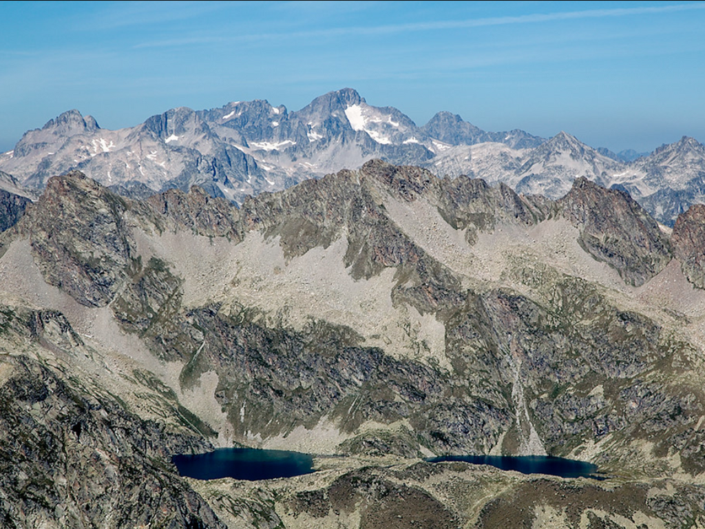 The environment becomes increasingly mineral. Here is a long excursion to the Pics of Culaus (2660 m and 2806 m) and Cestrède (2918 and 2947 m), following a ridge of more than two kilometers, from the soum det Guingays (2,451 m) to the west, to the tip of Cestrède.
The beginning is a mountain hike, but the final ascent requires a good level of climbing.
The departure is from the Fruitière (1371 m), from where the peaks are already clearly visible. Past the Russel refuge, we leave the path to enter the valley dominated by the Pic Inférieur de Culaus, where we still find grassy strips. The ascent to the peak is then made among the boulders. From the summit, magnificent view of the Lutour valley, the lakes of Estibe Aute and the Balaïtous.
We reach the junction with the Pic de Cestrède by descending towards the Kent passage.
The descent is long, first in the middle of the scree via the Culaus pass (2565 m) then the Culaus valley where we find the grassy areas.
Pic Mayouret (2688 m)
Duration 8 hours - Distance 11 km - D+ 1300 m
 This is the peak you can see from Chalet La Source on the right, just behind Mont Péguère.
Starting from the Pont d'Espagne car park, it's a long hike for seasoned hikers. It's worth the effort, as Pic Mayouret is very little frequented and wild, a wonderful viewpoint.
Arriving at the Gaube hotel, head due east to see a cairn and take a very steep path that climbs into the woods. At the end of the woods, you pass at the foot of Pic Meya and continue heading east, towards a scree slope that climbs towards the ridge line and takes you to the summit.
For the return loop, go through Clot de La Badète, following Pic de Labasse on the left, and Soum de Peyre Lance on the right.
Pic de Pébignau (2895 m)
Duration 5 hours - Distance 14 km – D+ 1600 m
 This peak is not visible from Chalet La Source, hidden by the Culaus in the foreground. From the Fruitière (1371m), climb towards the lake and the Estom hotel (1804m). Continuing the climb, leave the Arraillé pass path on the right to reach the Labas lake (2298m) then the small Estibet lakes (2360m), at the foot of the Pebignau peak. The climb to the summit is grassy at first, then becomes rocky. At the summit (2895m) there is a view of the Ardiden, Cestrède, Male Rouge, Soum d'Aspé peaks, the Labas and Sède peaks, the Arraillé pass and peak, Estibe Aute, the Estibe Aute lakes and the Estom lakes.
 Chanchou Peak (2949 m)
Duration 6 hours - Distance 18 km – D+ 1600 m
With Chanchou, we get closer to 3000!
The normal route has been done from the fruit tree (1374 m), by the Culaus pass (2,565 m). We then go up to the peak of Chanchou by the southern ridge. The terminal ascent requires concepts of climbing.
It is also possible to go through the Badet d'Aubiste valley and Lake Badet (1,800 m elevation).
Pic d'Ardiden (2988 m)
Duration 8h30 - Distance 15 km – D+ 1600 m
 A relatively uncrowded hike, the summit of which offers a huge panorama! Ardiden is only 12 meters away from joining the closed circle of the 3000 Pyrenean peaks.
From La Fruitière, you first reach the Russell refuge (1980m) after a 2-hour walk. Then continue south-east towards the Culaus pass. Following the cairns on the left, you turn off towards the Pourtau des Agudes breach, 1 hour away. The path then disappears among the boulders, but the cairns remain clearly visible. From the breach, it takes another 1-1.5 hours to reach the summit.
Pic du Petit Vignemale (3032 m) and Pique Longue (3298 m)
Petit Vignemale: Duration 12h – 26 km – D+ 1600m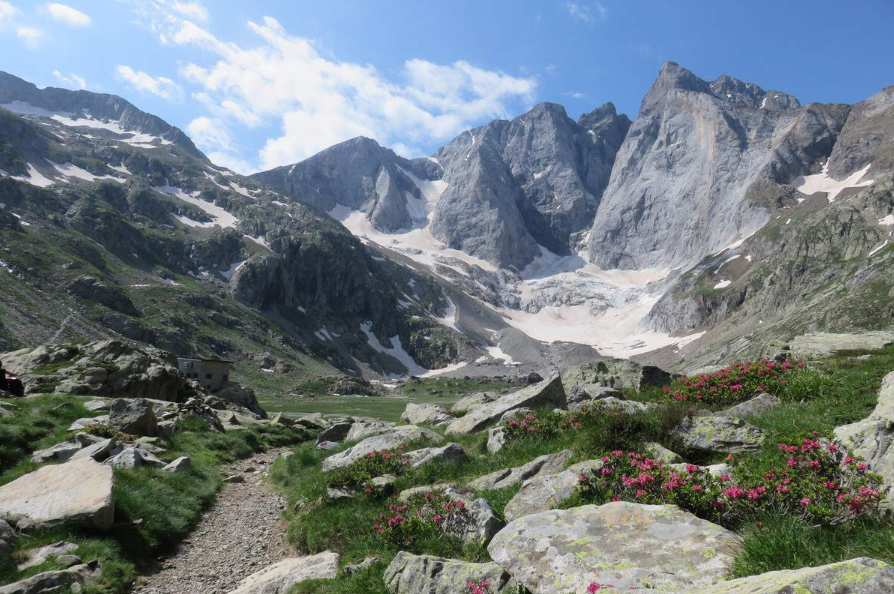 Highest point of the French Pyrenees, at the end of the Gaube valley, the Vignemale massif is not visible from the Chalet, hidden by Mont Péguère.
The hike begins at Pont d'Espagne (1473 m); we take the GR10 which passes by the Oulettes de Gaube refuge (2151 m) which we reach after 2h45 of walking, then 2 hours later by the Hourquette d'Ossoue pass (2734 m). We take the path which climbs along the ridge of Petit Vignemale, the summit of which we reach in 1 hour from Hourquette.
The return is made by the same route.
Here, in a few words, are some of the most beautiful hikes starting from Chalet La Source . Plenty to keep you busy for several weeks!
![]()
Share this article
{ampz: Sharing}
