Chalet La Source: Breathtaking views of the peaks!
 The view from Chalet La Source is a true invitation to discovery.
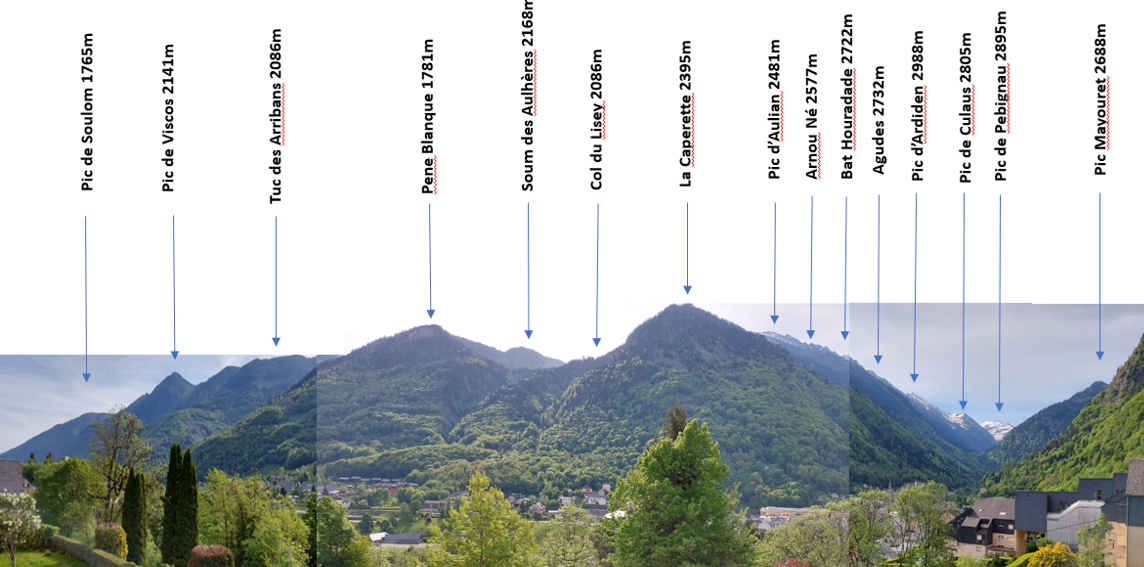
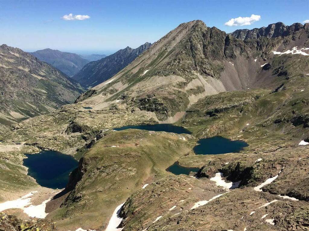
Sur tout l’horizon, une vingtaine de pics se succèdent, culminant à 2000m du côté nord de la vallée - Soulom, Viscos - et près de 3000m vers la chaîne frontalière au sud.
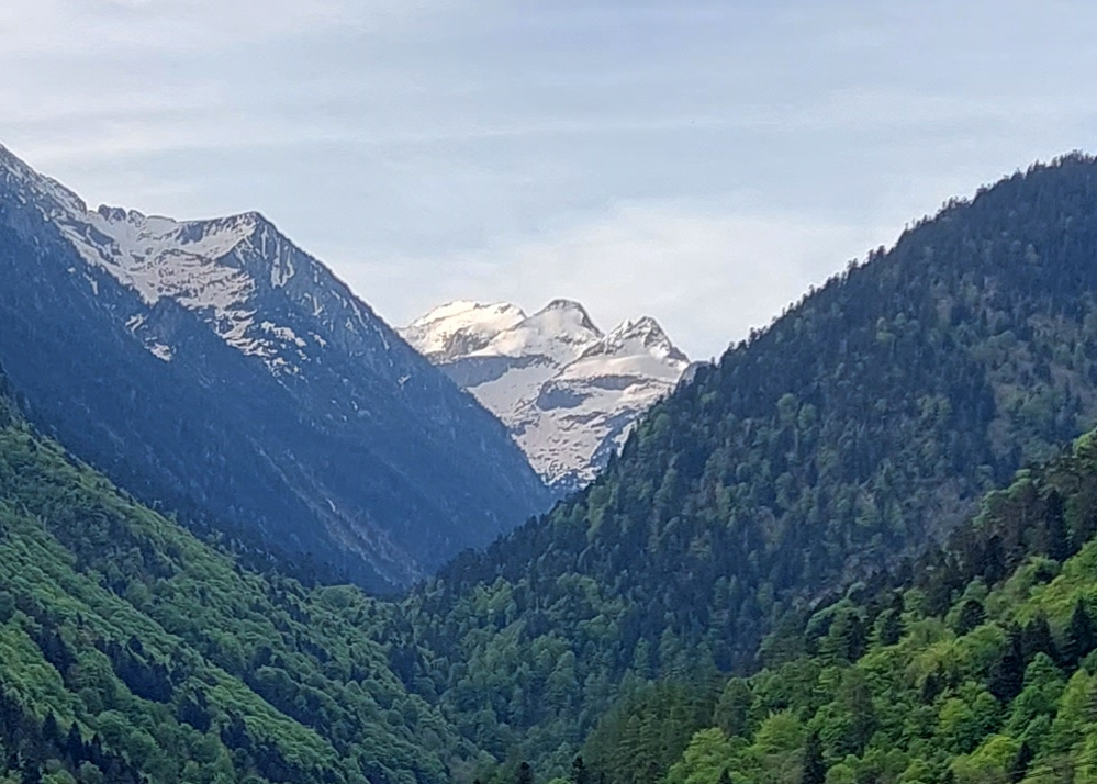
La vue coup de coeur depuis le Chalet : les pointes enneigées des pics de Culaus et du Pebignau, dans le cadre vert des pentes boisées ... en toute saison, on ne s'en lasse jamais !
Pic du Cabaliros (2332 m)
Durée 4h30 - Distance 9,5 km - D+ 700 m
 Situé tout à gauche du chalet (versant Ouest, côté nord), c'est l’un des plus hauts belvédères des Hautes Pyrénées, dans le pays de Saint Savin.
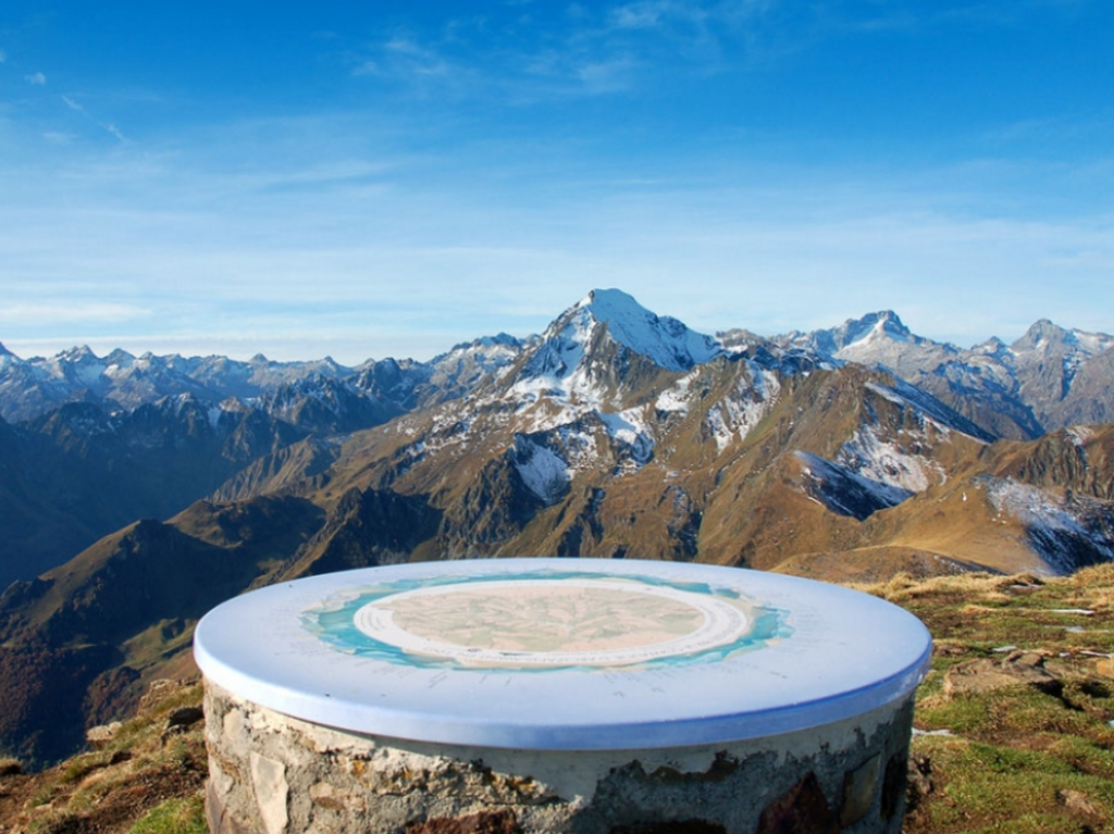
Le départ de la randonnée se trouve au bout de la route forestière de Sireix. Au sommet, une table d’orientation vous aidera à reconnaître tous les sommets en vue : Vignemale, Balaïtous, Pic du Midi de Bigorre, Néouvielle.
Il est possible également de partir depuis Cauterets, le sentier est bien marqué et sans difficulté mais évidemment bien plus long (17 km) avec un fort dénivelé (D+1300m) ; il faut alors compter environ 7h hors pauses.
A noter: c'est aussi le site, chaque année, d'un magnifique trail du même nom.
Pic de Viscos (2141 m)
Durée 5h – Distance 10 km – D+ 600 m
 On change de versant pour regarder en face du Chalet, vers la gauche (côté Nord). On distingue un pic de forme pyramidale, comme taillée au couteau. Avec des jumelles, une croix en fer forgé se détache nettement à son sommet : c'est le pic de Viscos. Depuis son sommet, il offre une vue fabuleuse, à 360° sur les vallées de Luz et Cauterets.
Cette randonnée nécessite une bonne condition physique, une bonne météo, et un pied sûr pour la partie finale.
Le départ est au parking de Béderet (1670 m), par la piste qui passe devant le départ du télésiège. On monte au Col de Riou (1949 m), puis jusqu’à la crête. Au bout de celle-ci, le sentier rejoint un petit col au pied du pic de Viscos : le sentier s'élève alors brusquement en direction du sommet. Cette partie raide et glissante, demande beaucoup de prudence.
Depuis le Viscos, on domine le pic de Soulom (1763 m) et le pic des Piquets un peu plus bas, juste à côté. La randonnée Soulom Viscos est d’ailleurs une belle classique.
Les crêtes du Massif d’Ardiden (2058 à 2577 m)
Durée 3 à 5h – Distance 6 à 10 km – D+ 500 à 850 m
 En suivant la crête face au chalet, plusieurs pointes s'égrènent, plus ou moins reliées les unes aux autres, formant un massif qui offre de nombreux circuits de randonnée.
Le départ sera, soit depuis Cauterets pour le versant Ouest (via Cancéru), soit depuis Luz-Ardiden pour le versant Est, de l'autre côté de la vallée (depuis le parking Aulian ou Béderet).
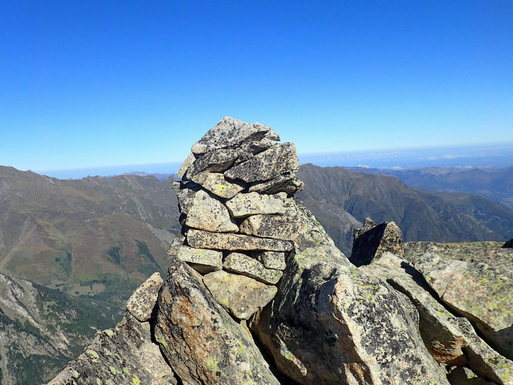
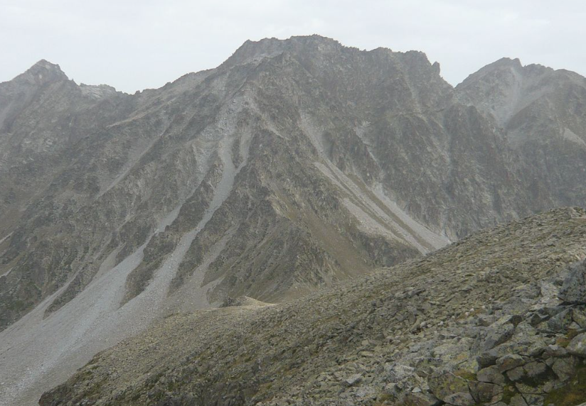
Les différents pics seront : Pène Nère (2058 m), Tuc des Arribans (2088 m), Soum des Aulhères (2168m), Soum de Peyre Haute (2336 m), la Caperette (2395 m), Pic d’Aulian (2481 m), et le point culminant, le Soum d'Arriou-Né (2577 m, photo ci-contre).
Depuis les crêtes, le panorama est magnifique, vers le Viscos au Nord, le Vignemale et le pic du Midi de Bigorre au Sud, le val d’Azun, la vallée de Lutour...
Col de Riou (1949 m), Col du Lisey (2086 m) et tour du Plateau de Lisey
Durée 6h – Distance 12 km – D+ 1140 m
 Pile en face du Chalet La Source, de l'autre côté du col de Lisey se trouve le magnifique plateau du même nom. C'est le site d'une magnifique randonnée de moyenne montagne, assez longue mais sans difficulté majeure.
Le départ se fait derrière les Thermes de César, via le GR qui monte aux anciens thermes de Pause, ou plus directement depuis le village de Cancéru. On rejoint le chalet de la reine Hortense, 1er balcon de Cauterets avec une belle vue sur la vallée de Cambasque.
En continuant la montée, le sentier sur la gauche s’enfonce en sous-bois en direction du Col de Riou. On prend ensuite vers le sud (à droite) pour atteindre le Col du Lisey, en remontant vers la crête de la Pène blanque du Lisey. On descend enfin au sud pour rejoindre le plateau du Lisey.
Le tour du plateau est splendide, boisé de hêtres, sapins pectinés, pins sylvestres et autres mélèzes. Un pur bonheur !
Soum des Agudes (2732m), Soum de Bat Houradade (2722m)
Durée 6h – Distance 13 km – D+ 1150m
 Avec ces deux pics, on prend un cran d'altitude, la végétation se fait plus rare et laisse place aux rocailles. C'est une randonnée bien montagnarde, depuis les granges d'Aynis au-dessus du village de Grust (1410m).
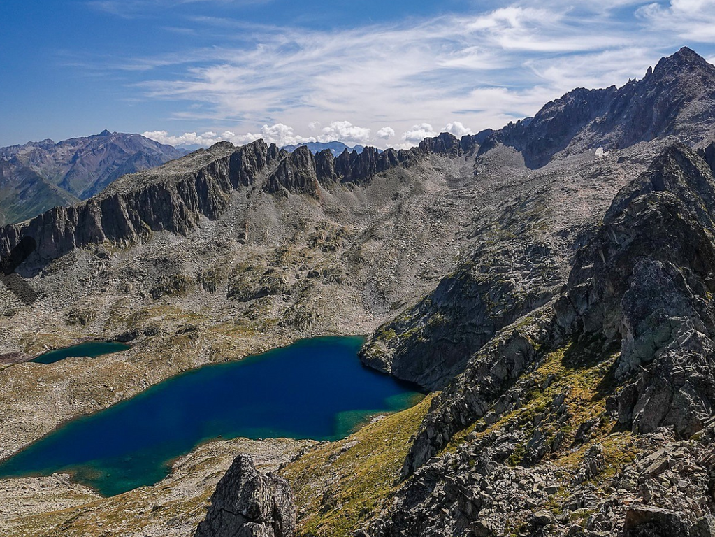
En suivant l’itinéraire des lacs d’Ardiden, on passe d’abord le petit lac de Lagues, puis le petit lac (lac de Cantet, 2382 m) et enfin le Lac Grand (2437m). On contourne celui-ci par le nord pour remonter la pente herbeuse qui mène sur la crête, juste au sud de la pointe des Agudes. On rejoint alors le Soum des Agudes par la crête. Puis c'est une descente vers le pourtère de Lamous (2628m) pour rejoindre le pied du soum de Bat Houradade.
La traversée jusqu'au Soum de Bat Houradade se fait en longeant la crête, pour descendre au pied du soum de Bat Houradade, avant la dernière montée par la ligne de crête.
La descente s’effectue par le même itinéraire, ou en passant au pied de l'aiguille de Lahazère en traversant au-dessus du lac de Lahazère.
Pic de Culaus (2806 m), Pic de Cestrède (2947 m)
Durée 7h - Distance 20 km – D+ 1900 m
 L'environnement devient de plus en plus minéral. Voici une longue excursion sur les Pics de Culaus (2660 m et 2806 m) et de Cestrède (2918 et 2947 m), en suivant une crête de plus de deux kilomètres, depuis le soum det Guingays (2 451 m) à l'ouest, jusqu'à la pointe de Cestrède.
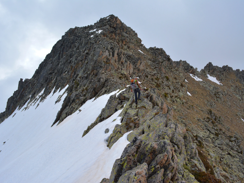
Le début est une randonnée montagnarde, mais l’ascension finale requiert un bon niveau en escalade.
Le départ est depuis la Fruitière (1371m), depuis laquelle les sommets sont déjà bien visibles. Passé le refuge Russel, on quitte le sentier pour s’engager dans le vallon dominé par le pic Inférieur de Culaus, où l’on trouve encore des bandes herbeuses. L’ascension vers le pic se fait ensuite au milieu des blocs. Depuis le sommet, vue magnifique sur la vallée de Lutour, les lacs d’Estibe Aute et le Balaïtous.
On rejoint la jonction avec le Pic de Cestrède en redescendant vers le passage de Kent.
La descente est longue, d’abord au milieu des pierriers par le col de Culaus (2565 m) puis le vallon de Culaus où on retrouve les zones herbeuses.
Pic Mayouret (2688 m)
Durée 8h - Distance 11 km - D+ 1300 m
 C’est le pic qu’on aperçoit depuis le Chalet La Source sur la droite, juste derrière le Mont Péguère.
Au départ du parking du Pont d’Espagne, c’est une longue randonnée pour des randonneurs aguerris. Le jeu en vaut la chandelle, car le Pic Mayouret est très peu fréquenté et sauvage, un formidable belvédère.
Arrivée à l'hôtellerie de Gaube, on prend plein Est pour apercevoir un cairn et emprunter une sente très raide qui monte dans le bois. A la sortie du bois, on passe au pied du pic Meya pour se diriger toujours vers l'Est, vers un pierrier qui monte vers la ligne de crête et vous emmène au sommet.
Pour le retour en boucle par le Clot de La Badète en longeant le pic de Labasse sur la gauche, le Soum de Peyre Lance à droite.
Pic de Pébignau (2895 m)
Durée 5h - Distance 14 km – D+ 1600 m
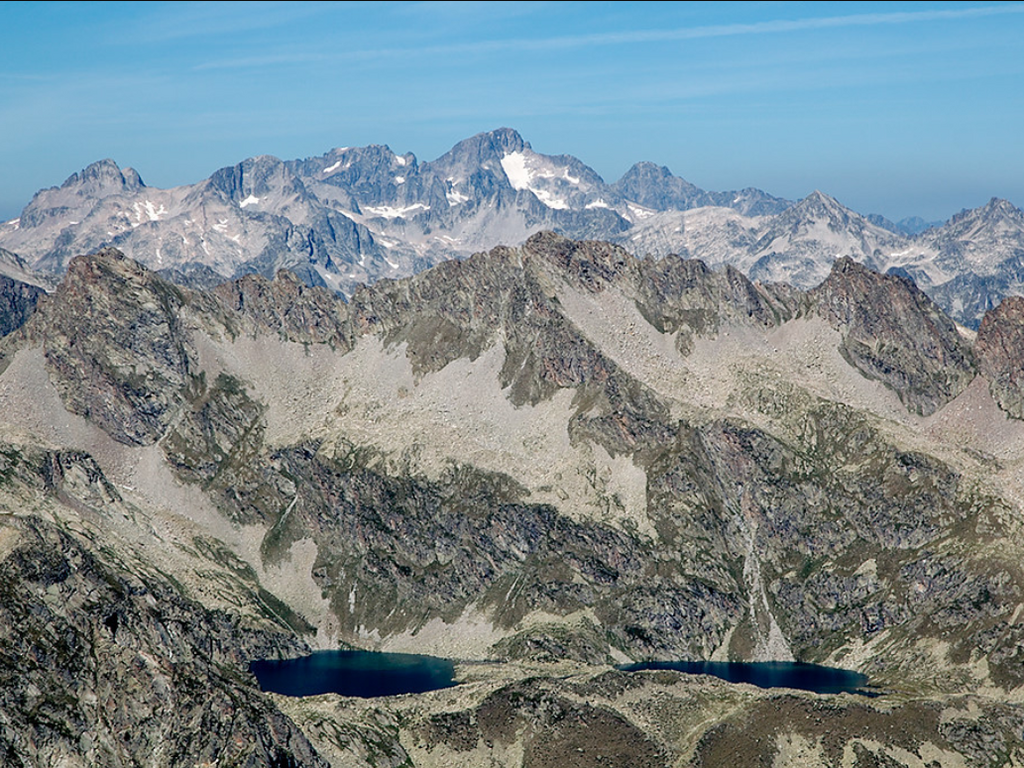
 This peak is not visible from Chalet La Source, as it is hidden by the Culaus in the foreground. From La Fruitière (1371m), head towards the lake and hotel of Estom (1804m). Continuing uphill, leave the path to the Col d'Arraillé on your right to reach Lac de Labas (2298m) and then the small lakes of Estibet (2360m), at the foot of Pic de Pebignau. The climb to the summit is initially grassy, then becomes rocky. At the summit (2895m), there are views of the peaks of Ardiden, Cestrède, Male Rouge, Soum d'Aspé, Pic de Labas, Pic de la Sède, Col and Pic d'Arraillé, Estibe Aute, the Estibe Aute lakes, and the Estom lakes.
 Pic de Chanchou (2949 m)
Durée 6h - Distance 18 km – D+ 1600 m
With Chanchou, we're getting close to 3000 meters!
The normal route starts from La Fruitière (1374 m), via the Col de Culaus (2565 m). From there, you ascend towards the summit of Chanchou along the south ridge. The final climb requires some climbing experience.
It's also possible to go via the Badet d'Aubiste valley and Lake Badet (1800 m elevation gain).
Pic d’Ardiden (2988 m)
Durée 8h30 - Distance 15 km – D+ 1600 m
 Une randonnée assez peu fréquentée, dont le sommet offre un panorama immense ! Il ne manque en effet que 12 m à l’Ardiden pour rejoindre le cercle fermé des 3000 pyrénéens.
Depuis la Fruitière, on rejoint d’abord de refuge Russell (1980m) après 2h de marche. On continue alors direction Sud-Est en direction du col de Culaus. En suivant les cairns sur la gauche, on bifurque vers la brèche de Pourtau des Agudes, à 1h. La sente se perd alors au milieu des blocs mais les cairns restent bien visibles. Depuis la brèche, il faut compter encore 1h-1h30 pour atteindre le sommet.
Pic du Petit Vignemale (3032 m) et Pique Longue (3298 m)
Petit Vignemale : Durée 12h – 26 km – D+ 1600m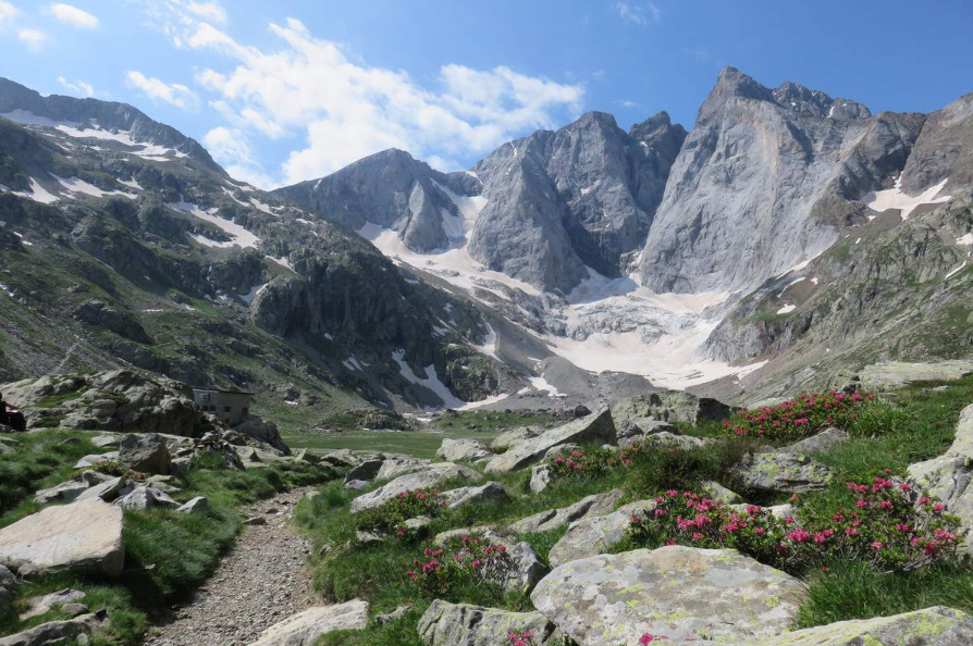 Point culminant des Pyrénées françaises, à l’extrémité de la vallée de Gaube, le massif du Vignemale n’est pas visible depuis le Chalet, masqué par le mont Péguère.
La randonnée commence au Pont d’Espagne (1473 m) ; on empruntant le GR10 qui passe par le refuge des Oulettes de Gaube (2151m) que l’on atteint après 2h45 de marche, puis 2h plus tard par le col de la Hourquette d’Ossoue (2734 m). On emprunte la sente qui monte le long de la crête du Petit Vignemale, dont on atteint le sommet en 1h depuis la Hourquette.
Le retour se fait par le même itinéraire.
Voilà, en quelques mots, quelques unes des plus belles randonnées au départ du Chalet La Source. De quoi bien s'occuper pendant plusieurs semaines !
![]()
Share this article
{ampz: Sharing}
